For our track and location updated every 10 minutes (if you see Nashville, we haven’t started yet) Just below that is Glympse, which is updated quite often.
2023-09-01 Puerto Penasco to Kanab UT 553 miles Official miles per our passports
We both probably had a good nights sleep. I did hear the wind howl again, but it wasn’t all night. The next days ride is on your mind which makes it tough to fall asleep. I believe we were up about 4ish. After our routine in the room, we were at our bikes about 5am, with maybe 2 thirds of the bikes in the lot gone. We took off our bike covers to begin to pack only to discover there was sand ever where on the bikes. We finished loading up, turned in our token coin to the guy in the lobby collecting them, and off we went at 5:30 am. It was still dark, and there was some wind and it was still warm but comfortable.
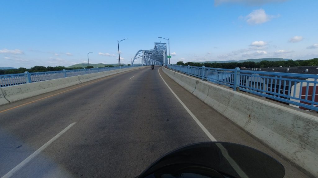
Day one official route
When we start off, there are a few bikes ahead of us and we are somewhat in a pack. Once we get through the town lights, we are on Mex 8, the main road to the border. Still very dark but most of the bikes catch up to each other and pretty soon, it is a long line of bikes – or it seemed that way in the dark. I’m unfamiliar with these Mexico roads here, and I’m hesitant to do much passing with such a line of bikes and it still being dark. There are critters out and I can’t really see the road for any curves, blind spots, pot holes, sand drifts or washouts. I know we only have about 60 miles or less to the border so I just decide to just relax and wait this out. From past three flags I remember it will start thinning out once we cross the border.
As when riding in a group of motorcycles, especially when there are many, the ride in the line is like a rubber band due to everyone riding in a group. Speeds up, slow down, speed up, slow down etc. Just had to be patient for the sunlight and the border crossing. When there was more daylight and you could start to make out the road, we started to make some passes and by the time we got to the border, the line was not long at all. Maybe 10-12 bikes ahead of us. Rick and I lucked out on the border as they opened up another gate just as we arrived so the wait was minimal.
Once we crossed, like I thought, it was cleared out of bikes on the road as a lot of riders started taking breaks, getting gas or stopping for breakfast. We were riding in the 75 – 80 mph range on AZ 85 through Organ Pipe Cactus National Monument Park in the southern part of Arizona.
We continued to ride north on AZ 85 till we hit I-10, which we took east towards Phoenix. The route didn’t go into Phoenix, but skirted Glendale/Phoenix area via 101 to I-17 north to Flagstaff. The skies were generally overcast, with patchy blue areas. There looked like threatening clouds east of us but generally it look like we were going to have a dry day.
I-17 north is a fun beautiful road, a bit crowded this holiday weekend, it was moving but always climbing in elevation for the most part as you head into the Sedona area. We found that riding in the right lane was quicker and could pass more cars that were all in the left lane. I-17 ends at I-40 by Flagstaff, which we take for a short time and get of on AZ 89 north, which takes you the east side of the Grand Canyon. All we had to do was follow the signs for 89 north till sometime past Paige AZ, would would catch 89A through Marble canyon and past the entrance to the North Rim of the Grand Canyon.
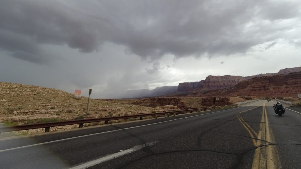
As we continued north in the afternoon, the skies were starting to get cloudier and you could start to see showers off in the distant areas of the desert. When we were in the Phoenix area, it was hot and still humid. As we climbed on I-17 to Flagstaff, it started getting cooler in the higher elevations to about 70 degrees when we were in Flagstaff. After Flagstaff you drop back down into the desert and warm up again, and by the time we get to the 89A/89 junction, it is about 3ish in the afternoon and we could see the rain behind us and just to the side of us.
I pulled off the road to get my jacket on, put my helmet on, and to verify with Rick that there was a gas station somewhere ahead of us as we were probably still about 65-70 miles from Kanab and it would be tight to push it. It starts to sprinkle just as we get going and we head forward to the next gas station which Rick’s gps was saying was 10 miles.
Starting on AZ 89A through Marble Canyon
Sure enough, when we see the gas station it starts raining hard. We are under the canopy when we are filling up our bikes and we decide to wait a bit and let this storm push most it’s energy out. After about a 10 minute wait, the rain was light and we continued along, but at a slower pass as we climbed up a mountain and over a pass before we were heading down into Kanab UT to our first checkpoint at about 4:30 pm.
There were some volunteers to guide us into the first checkpoint, which was at the community center in Kanab. It was still a steady drizzle when we got there. There were a handful of bikes in the parking lot when pulled in. We parked our bikes, grabbed our passports and as we made our way towards the entrance, we said hi to the father/son team that sat at our dinner table at the start banquet as they came out. Inside it was dry and as it turned out, this was also the best spread of snacks. There was coffee for us along with oranges/apples/bananas, chewy cookies, and assorted snack bars. We got our books stamped-I asked where we were in placement and they said we were in the top 1/3 as people were just starting to come in.
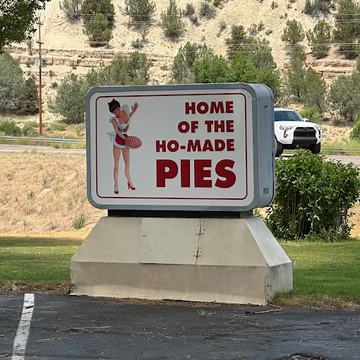
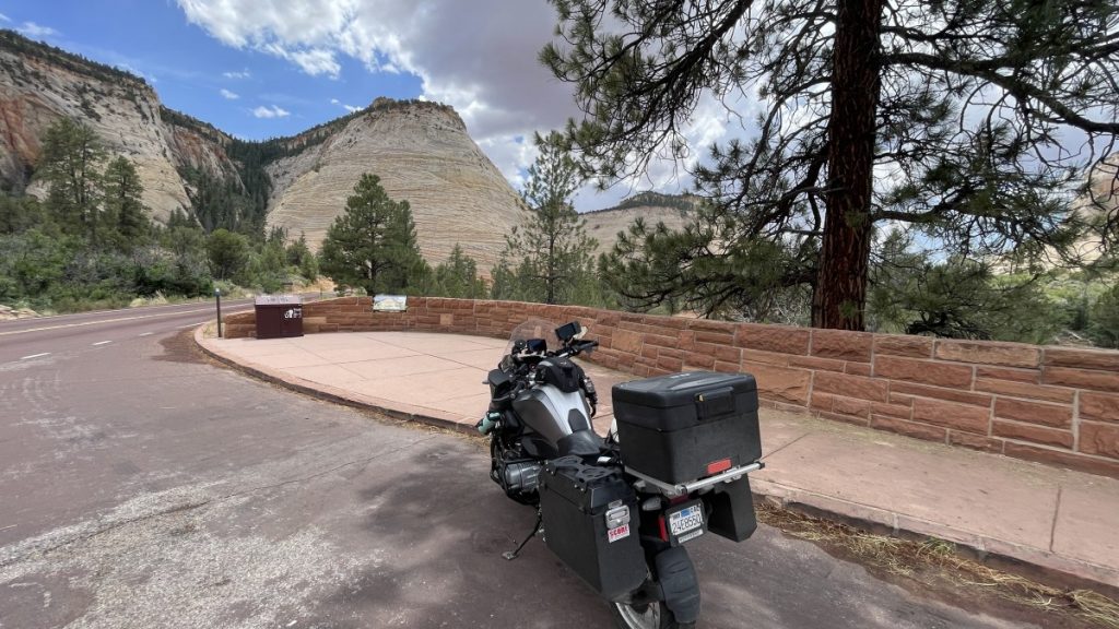
Our hotel for the night was not in Kanab, but 17 more miles north on AZ 89 at Mount Carmel Junction, which is junction 9 that take you into the east entrance to Zion National Park. This is a familiar stop for us going to Sturgis and I like it as there is a gas station, a Best Western, and the Thunderbird Restaurant all on premise, which is nice after a hard day of riding.
After we checked in, we rinsed our bikes down, not just from the rain but from the dust storm the night before in Puerto Penasco, then cleaned up for a great dinner and what this place is famous for, Ho-made pies.
After our belly’s were full, we made it back to the rooms and settled in for the night as we wanted to get up early for the biggest mileage day of this 4 day rally, which was 610. but we already did 17 of it to get to the pies….
Ok, my sis always complain that I never finish a trip blog that once I get home, I stop. Well, she is partially true on that…. So I am going to update and finish this website up of summer travel!
Yes, we have been home for almost a month now since finishing the 3 Flags Classic. So here is a summary of that ride (to the best of my memory).
The previous post was a teaser that we were starting our the next morning and that I wasn’t going to be posting much. Turns out I didn’t post AT ALL. But we did do the ride. The 3 Flags Classic is a rally style ride that happens over Labor Day weekend where the route changes every year, has 4 checkpoints to complete within a specific window, and traverses three country’s – Mexico, US and Canada. This one was the 46th annual starting in Puerto Peñasco (Rocky Point) Sonora Mexico on Friday Sept 1st, through checkpoints Knab UT on 9/1/23, Idaho Falls ID on 9/2/23, Sandpoint ID on 9/3/23 and finally Calgary Alberta Canada on 9/4/23.
08/30/2023
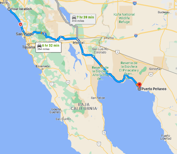
Rick arrived at my house on Wednesday morning, August 30th for our ride to Puerto Peñasco. We wanted to attend the opening banquet on Wednesday night and also get a day to relax before we ventured on 4 tall days of riding. The weather called for a clear day but hot once we went into the desert.
I’ve been to San Felipe many times in Baja and Puerto Peñasco is located on the opposite side of the Sea of Cortez (aka Gulf of California) of San Felipe, but I never been to Puerto Penasco. Our ride started with a nice cool clear ride along the coast as we headed to San Diego, but turn hot and muggy as we started heading east. Even in the mountains that you cross over east from San Diego didn’t give us much relief at elevation – and when we dropped down into the desert 30 miles from Mexicali, the heat and humidity was on!
Our route to Puerto Penasco
We gassed up just before crossing the border and I get some intel from the clerk about gas stops going to our destination. Today was also the projected hottest day and we could expect cooler days ahead, although that is no constellation right now…. we could feel the higher than normal humidity along with the sunny weather and 105 degrees in the shade temps, but we don’t ride in the shade. We also had about 190 miles to go and it was 11 a.m.
We crossed the border into Mexicali, and as typical, no stopping at the border, just go through the maze and bumps. So far, the ride is familiar to me as it is as though we are heading to San Felipe, which we are till we need to cut across the top of the Gulf of California. Once through Mexicali, the road to San Felipe is good and fast. I’m thinking we will be at Puerto Penasco in about another 1 1/2 as the roads are probably the same. WRONG!
About 30 miles from Mexicali we turn off of Mex 5 and take Mex 4. Mex 5 to San Felipe is mostly wide open with a very good road and non stop till Mex 3. I though this would be the same, but it was really a bunch of small farm towns we had to go through, looking for the stop signs, watching out for dogs, pot holes and don’t forget the surprise speed bumps that you have no warning for. It was tedious for the next 43 miles and probably took us 1 1/2 as we had to negotiate some turns in these towns.
Finally the towns disappeared but we still had about 120 miles to go in this heat and desert winds that were blowing. We continued for a bit, slowing down for the sand covered areas and the recent washouts on the side of the road from last weeks hurricane remnants. Sometimes almost half your lane was gone due to the washout.
We ventured off our route to go into the town of El Golfo de Santa Clara to gas up (the intel I received from the clerk) where a blind man was pleading for money while I was filling my tank. It was a miracle that after a gave him a some greenbacks that his eyesight apparently came back as he commented how he like my bike.
We continued in the heat, plodding along and being carful of the road hazards as we came across them, contend with drifting sands from the wind and a few construction areas. But the drive started to become interesting as you could see the blue sea off to our right in this desert landscape and as we approached the town of Puerto Penasco you could see a group of high rises rising from the desert along the coast. We topped off our tanks before heading to our host hotel so we wouldn’t have to worry about it.
We pull into the host hotel area about 4 pm and there are quite a few bikes already here. It was still very hot and very very humid. We park and enter the building for check in and we must of looked beat as there was a greeter there with a cooler full of bottled waters and he kept asking if I wanted more water. It was a relief to check into our room that had the AC running and both of us just chilled for a while drinking our water.
We check in for the ride and picked up our passports and other items – a yellow ribbon to tie on our bikes to identify 3 flag riders while we are riding the route, a couple of wrist bands we had to wear (One for the hotel security at Playa Bonita, the other for dinner in Calgary) and we were given a token coin with our number on it that we would turn in the morning we start the ride. The passport was a nice summary of our ride legs, with our picture in it, our ride number and places for a stamp for each checkpoint,
After check-in it was time to head to the pool, where there was a bar and other riders. Even though the pool water was warm, it was nice to relax and have a cold beer while wading in the water. Later that night we had our banquet dinner outside. Rick bought me a Cadillac margarita before we ate, but some time after my 2nd helping of food, that margarita hit me like I got roofied… But it must have been good tequila as I didn’t wake up with a hang over.
08/31/2023
During the night, the wind was just howling! The small crevice in our sliding glass patio door was just howling with a little shaking too. I had washed socks, t-shirt and underwear during the day and had them out on the patio. During the night I went out on the patio to only find my socks and underwear. The t-shirt was down below on the bush. So off I went to get it. While walking out side it was like a mini sandstorm. I retrieved my shirt and heading back I noticed someone’s bike was actually pushed over on its side from the wind! I headed back and went back to sleep.
The morning, the wind was strong but not the sandstorm the night before. We got up and cleaned up for breakfast. While heading out, we crossed paths with a guy from Newport who we met the day before in the pool, and he recommended a place in town for breakfast, so we took a cab there and he was right. It was an excellent place and air conditioned! It was still hot and humid today, but not quite as bad as the day before.
Most of the day was just relaxing, hanging at the pool, and reviewing our stuff for our coming days of riding. For dinner, we again got a cab and went to a place that Jean had memories of going to when she use to come to this oasis in the desert. It was still there!
We got to bed early and decided to get up at 4:30 or 5:00 am and be rolling by 5:30 am.
Tomorrow, Wednesday 8/30/2023, Rick and I leave for our Phase 3 summer ride, the Three Flags Classic. The ride starts on Friday, September 1 in Puerto Penasco, Son, Mexico and will end on Monday September 4th in Calgary Canada.
Wednesday is a ride to Mexico, Thursday a day to register along with about 300 other riders, some workshops, relaxation, a dinner and a early bedtime retirement for a 4:00 am start time on Friday September 1. We will have 4 checkpoints over the weekend we must go through at particular times, which are Kanab UT, Idaho Falls ID, Sandpoint ID, and Calgary Canada. A suggested route will be offered up (usually scenic roads) that we can follow (and probably will) that is approximately 2,100 miles. Please visit the Three Flags Classic page for more details.
I will not be bringing my laptop, but will use my iPhone, but posting will be limited (mostly pictures) as we will need to cover on average 550 miles to 650 miles a day for three days. So probably no pontification observations from my mind, but you will be able to follow us on the spot and Glympse on the “Current Location” page.
It was nice to be home for about a month, both of us services our bikes, sporting some fresh tires, new oil and now rested bodies.
The goal here is to beat the heat and the desert wind, so an early start is a must.
Last night before going to bed, I set my alarm for 3:45 am as I wanted wheels up at 4:30 am, an hour before sunrise. I wake up and look at the clock, i’t 3:30 am. Great, a little extra time to relax and get ready, plus I woke up, not an alarm waking me up in some weird part of my sleep cycle.
I do the three S’s, get dress and head to the office lobby where they have one of those fancy coffee machines where I can make a cup of coffee and add a shot of expresso – I’m my own barista! While enjoying my coffee I load up the bike, attach my GPS’s, start the InReach device and go back into the room to relax a bit. I fill up my thermos with water, I check the fridge for items I bought the day before, and have my Zero sugars, Starbucks Moca Triple Shot as a booster. One last go around in the room, one more trip to the head and it’s 4:30 am, time to roll!
It’s dark outside, 84 degrees and I’m fired up with caffeine. No jacket required as I pull out of Mesquite and enter I-15 south. No planning require here, this is a no brainer, I-15 all the way. 350 miles, tank is full already, I know my two remaining gas stops: Stateline, Barstow, then home. 80 miles to Vegas, 40 miles to Stateline. Then enter California, up the mountain where it will cool down for 40 miles, drop down to the big thermometer in Baker, then another 60 miles to Barstow. Top off then the last push home….
After about 15 minutes into my ride, I see it. Scrapes of daylight. I don’t see it in front of me as I’m heading west, but I see it in my mirrors and I do a head check to confirm. That is when I like to leave in the morning. It is when Scrapes of Daylight start. It’s the period before sunrise, the reverse of a sunset. The sky gets lighter, but there is no sun but the morning gets cooler as the sun rises.
Sunrise is at 5:30 am today and in an hour I find myself in north Las Vegas and its 64 degrees. Of course the road is under construction, but nobody is obeying the speed limit of 55 mph, we are all doing 80 until you get to downtown and it comes to a crawl. Not really a crawl, but feels like it after doing 80, we are doing about 40 mph. Good God, why are there so many people going to work now….
Time for the first gas stop – Jean Nevada as oppose to Stateline – new Chevron super gas station here with a bazillion pumps and a auditorium for a bathroom. Humorous bathrooms too.
It’s a quarter to six as I depart Jean and 10 miles later, enter the State of California. There is the huge solar array to your right as you climb the next desert mountain range and the temps drop to low 80’s for the next 40 miles. 10 miles from Baker you start your descent into Baker and the worlds largest outdoor thermometer. The thermometer is reading 89 as I cruise by Baker, which is the gateway to Death Valley.
You come over another desert mountain range but the temps don’t drop much here in this section, as they stay in the mid to upper 80’s. Those temps are comfortable when your riding and the day is still good with no wind for the next 60 miles to Barstow,
About 40 miles from Barstow, the road basically flattens out and get straight. Here it seems there is just a race. 80 is the standing still and it seem your are passing cars going near 100 as everyone at this time and section has got it pinned.
Civilization appears as you near Barstow and the freeway widens from 2 to three lanes. Take the Lenwood exit to the TA Travel Center, park at the pump, and at this age, run into the bathroom first, then get gas. Hop back on the bike, and back on the freeway for the last push home. The weather has been great – it’s in the mid 80’s here, no wind, traffic is moving and not overly jammed. I’m wondering if I left a tad too early as I might hit the commuter traffic as I descend down into the LA basin.
It’s clear sailing from Barstow to just before Victorville, and it appears they are adding bridges and a lane on the freeway in this ever gowning desert town. It gets a little nutty as it is neck to neck of cars all moving fast with lane shifts and division in the construction area. Are we going 55? No…
The construction site ends and we reach the top of the Cajon pass and we have the great drop down into the LA basin. This mid-range mountain highway dividing the San Gabriel & San Bernardino mountains, with scenic views is 5 to 8 lanes wide and anyone or anything can go fast as it is all downhill. And as you drop down and get closer to the basin you see it – the brown layer of smog in the air that permeates the inland area during the hot summer months.
Once you reach the bottom of the Cajon pass its roughly 70 miles till I get home. I-15 south to State Route 91 to Toll Road 241 to I-5 to home… I pull in my driveway at 9:45 am, shut off my bike, dismount the bike and I get a text message from Rick welcoming me home and commenting on great time.
As I look at my bike sitting on the driveway of my home, the bike was my home for the last 34 days – just two wheels and the outdoors. My bike is hot and dirty, caked with grasshoppers still but it treated me well on this journey. The tires were new when I left, but I will need to get new rubber before our final ride for the summer, The Three Flags Classic over labor day weekend.
My yard and neighborhood always look “different” when I return from a long trip. I unload the bike, start laundry, open up the house and the relax before heading to the store for groceries. I’ll have one more post before the Three Flags Classic with some stats and thoughts of this ride. I also want to thank those who commented and kept the motivation for me to keep the blog up, it was truly, truly appreciated!
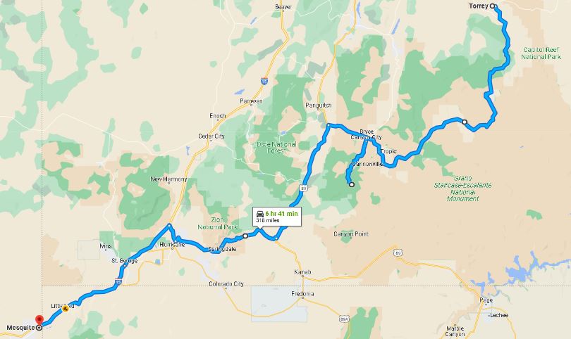
It’s clear morning in Torrey UT and weather forecast shows sunny day, and of course, subject to change. I’ll have an easy day, just about 250-300ish miles to Mesquite NV, where I can make a judgement call to go forward or hang in Mesquite – the latter which is the typical and probable. Rick should be crossing the desert and getting home today.
Now you are not going to get any of those nice pictures from the road as Rick has been taking those with his camera. I’ll be stopping because all I have is my phone.
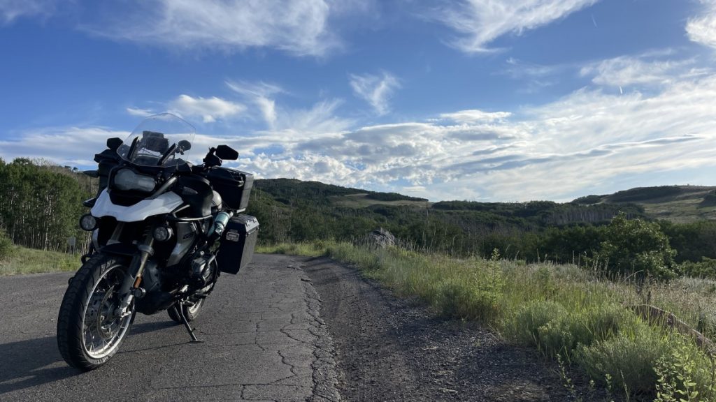
I take advantage to the easier day and get a late start at about 8:30 am. There are a couple of ways to get to Mesquite from Torrey, and I’m choosing a road we did in May and was one of our 15 roads, UT12 scenic byway through the Grand Staircase – Escalante area of Utah. Great roads never get old. This road makes its way across a mountain pass and then through small remote towns along some great ridge routes.
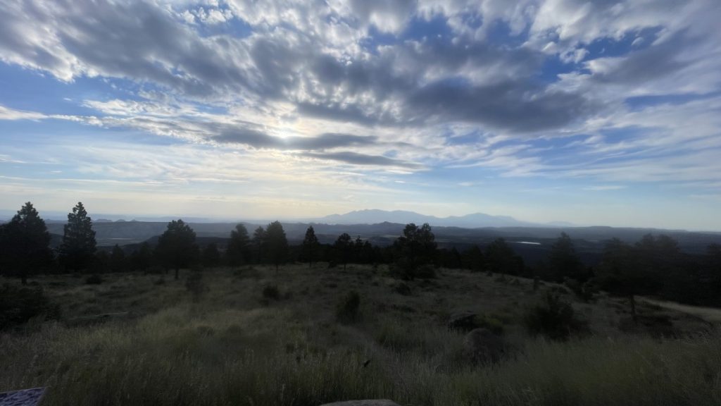
Not a cloud in the sky as I leave Torrey on UT12 heading south. You start to climb immediately from Torrey up into the national forest of Boulder Mountain. I take it slow as there are plenty of deer up here and cattle. Sure enough, plenty of deer I see but no close calls. Most of the close calls are the cows munching just off the road, although no problem, you never know if they will charge you on a bike. I just slow down to a crawl and just meander by.
There are several overlooks along this stretch as you climb up to and descend down Boulder Mountain Pass and I take advantage to stop at these. They overlook vast areas towards Capital Reef National Park and Grand Staircase-Escalante National Monument. Pictures do not do it justice.
After descending down the mountain, you enter a dryer windswept area with rounded hills and lots of exposed rocks and canyons. You snake around and climb and dip into these areas. One spot you are riding on the ridge top of the mountain and on both sides of the road are steep drop-offs to the canyon below.
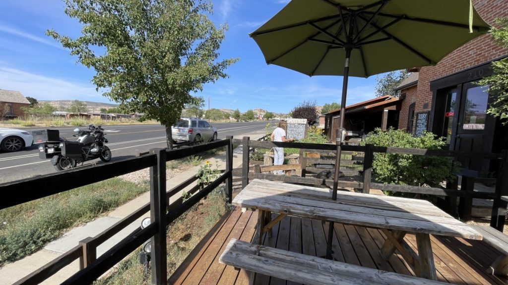
I continue along this 112 mile stretch of UT12 to Bryce Canyon and stop midway in Escalante as my eye catches “Espresso” sign and I turn around to go to a quaint organic coffee/bakery/grocery store for an eye opener and a small break.
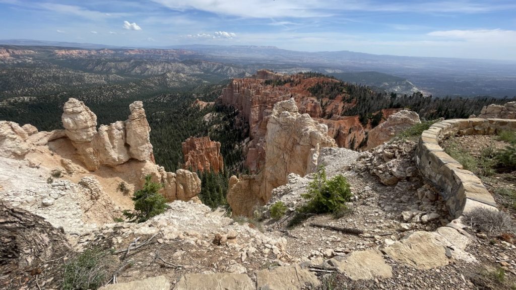
The day continues to warm up as I make my way through the next 60 miles and the towns of Henrieville, Cannonville and Tropic before ascending up towards the entrance of Bryce Canyon National Park. When going to Sturgis, this is one of the routes we have used, where you just ride by Bryce Canyon and never enter the park. Last time I entered and explored the park was in 1992. The weather was good, the day still early and Mesquite is only 165 miles away (3 hours) so I wanted to explore Bryce Canyon and stop at every viewpoint, something I never did.
There is just one road into Bryce Canyon and it is a 20 mile road out to a point and you take it right back. All the view point are on the left, so I plan on riding to the point first, then stop at all the other viewpoints on the way back so all my turns are right hand turns.
Again, pictures do not do this place justice, and just riding through probably holds true to that also. I imagine you need to hike it to truly enjoy its natural beauty. This whole area of Southern Utah needs more exploring beyond the roads and more time. There are plenty of other natural bridges and vistas off on the dirt roads and hiking trails. Next on the bucket list, spend more time in Utah.
It is about noon when I finish with Bryce Canyon and in the mid eighties. I check on Rick on Life360 and I see he made it to Orange County, so he beat the desert heat. The clouds here in the sky look promising that the next three plus hours I should make it to Mesquite without a rain shower. It is only 160 miles, but I plan on riding through Zion National Park, which will be slow going but again, a great road should never be missed.
From Bryce Canyon it is a slow descent as I make my way to Mt Carmel Junction where you then climb back up for 13 miles to the east entrance of Zion National Park, where at that point you descent the rest of the way. By the time I arrive at Mt Carmel Junction, it was in the mid 90’s and you can see some clouds gathering to “party”, my way of saying to make showers. On the climb to the parks entrance, it was windy as you can see the party off to my left but the misting was welcome as it cooled me off and it was brief.
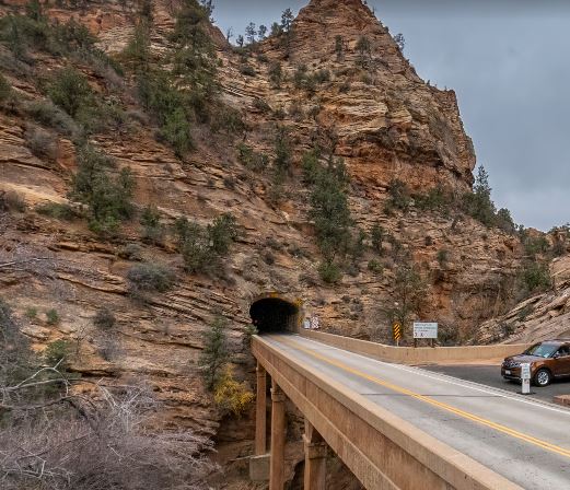
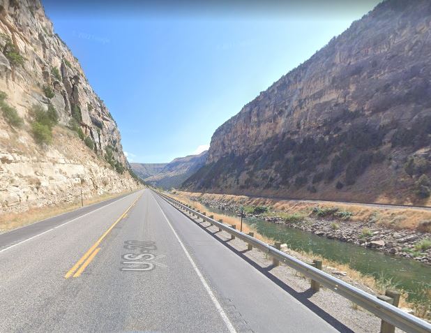
East Tunnel Entrance
As soon as you enter the park from the east entrance, you are in a canyon snaking your way through view after view – almost a slot canyon. For the next 5 miles you take it slow and enjoy the views of Checkboard Mesa and Keyhole Canyon till you get to the tunnel that was completed in 1930 and is 1.1 miles long with viewpoints/air vents along the way carved right through the mountain side. A line of cars had to wait to enter the tunnel as they will stop traffic to let an over sided RV pass through. It is hot and sunny as I wait on the east side of the tunnel, but when we go through the tunnel and come out on the west side, I’m greeted with a steady drizzle that turns to a slow steady rain
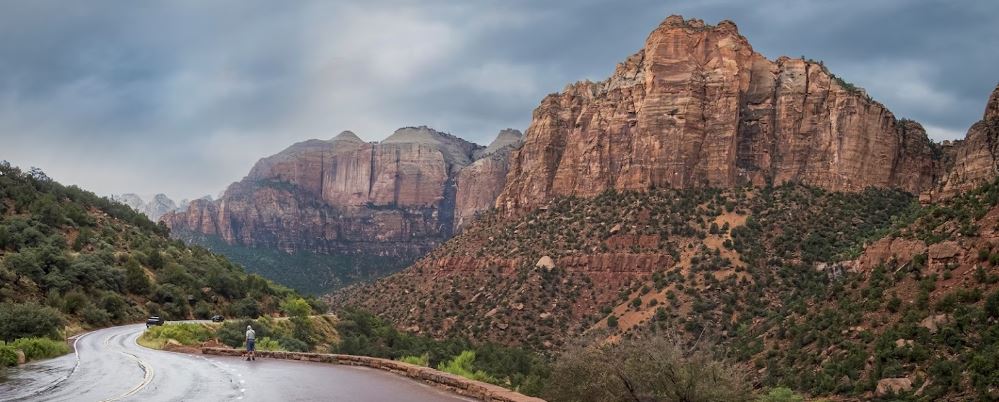
I take it very slow for the next 4 miles as you descend on tight switchbacks down the mountain into the canyon floor below. I start to see white foam on the road which brings back memories of our phase 1 ride and the ride into Cortez CO, but this is foam, not hail. As I exit the park on the west side into Springdale UT, the rain returns to a drizzle and as I continue west, it comes to a stop.
My shirt is totally wet but it is 104 degrees on this side of Utah. And it gets hotter as I make my way to St. George. Rick would have been in shock as I stopped in Hurricane to put my jacket on in 110 degree heat because I forgot to pack a long sleeve white shirt for the desert ride. My arms felt like they were on fire with the sun and heat and I needed to cover up the arms for the 50 plus mile ride into ride into Mesquite.
Even though the signs say 110 degrees, you have to remember that is measured in the shade. So it is hotter here in the sun and with black asphalt all around you. Not much you can do but relax, look twice, drink plenty of water, and focus. I actually ride slower in this heat and have trucks pass me while I relax and enjoy the 10 mile ride descending through Virgin River Canyon. It is amazing they crammed an Interstate through this beautiful desert canyon. It can be hectic with the swirling canyon winds, the trucks and cars racing through these long tight corners, all while trying to enjoy the view.
At the west end of the canyon you ride out of a slot canyon where they somehow barely fit the 4 interstate lanes in along with the river and Boom, you bust out and are greeted with a wide flat basin and a blast of hot desert wind with the afternoon sun shining in your face. You only have to ride 12 more miles to Mesquite with the hot strong afternoon wind blowing across the road.
I exit off the first exit and immediately turn right into a gas station to gas up and put my helmet on. I haven’t had to put the helmet on since we exited out of Canada into Wisconsin. At this point it is 112 degrees and I’m 360 miles from home. One time I kept going. It is not going to be this time. I check into the Best Western, turn up the air conditioner, walk next door to get water and energy drink for an early morning departure, then cleaned up. After a bit of relaxing, brave the heat again to walk next door to Peggy Sue’s Dinner and have a salad for dinner before retiring early.
From Worland WY we are about a little over 1,000 miles from home, with the last 350ish miles crossing the Mojave Desert. The typical game plan is get to St. George, UT/ Mesquite NV area, then wake up O dark thirty to cross the desert to beat the heat and beat the Las Vegas traffic. That leaves Mesquite about 700-800 miles away depending on routes and its a doable day ride, or break it up to a couple of 300ish day rides. The night before called for hot weather in the areas we would be passing through, with temps in the 90’s most of the time and St. George/Mesquite area in the 105-110 range.
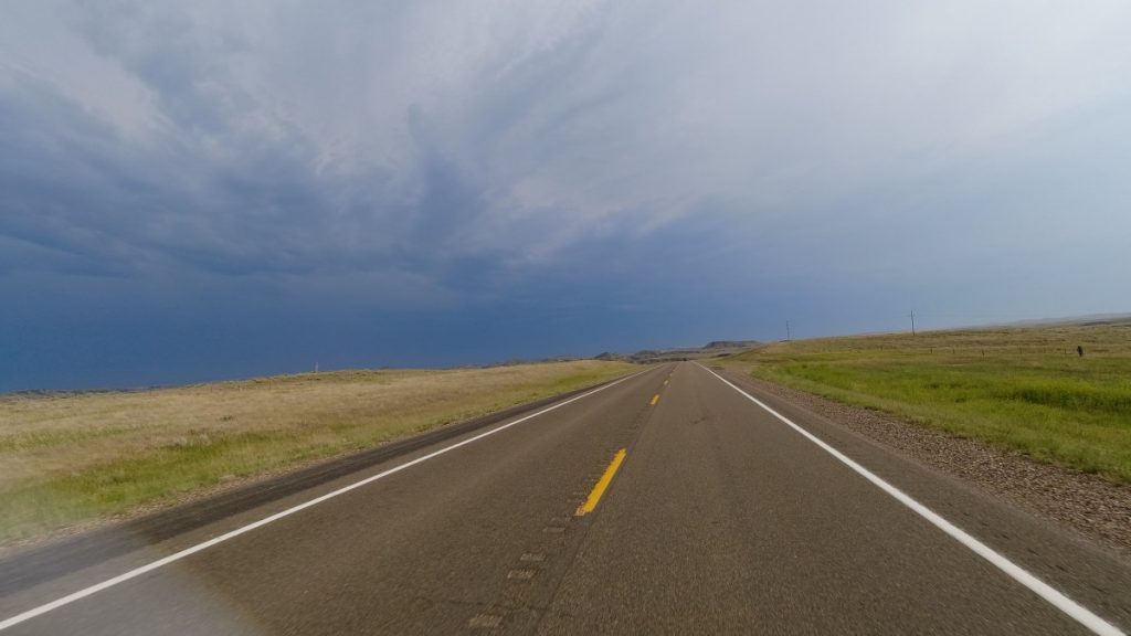
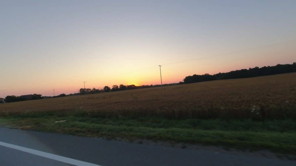
We started the day earlier today at about 5 am due to the hot forecasted day. It was cool this early morning with high clouds so we started with our jackets. We got to enjoy watching the sunrise as we headed southwest through Wyoming. About 40 minutes later we were going through the town of Thermopolis heading towards Shoshoni. The ride from Thermopolis to Shoshoni turned out to be a treat this morning.
With no one on the road this early, the road dropped through a long wide canyon and then entered into a narrow canyon along Wind River call appropriate enough, Wind River Canyon.
The river on the right that seem to be flowing uphill as we descended into this canyon and the early morning sun shadowing the walls of the canyon made the early morning wakeup call worth it.
All morning it was cool and it became overcast. The forecast for heat just hasn’t materialized yet, although it is still early in the morning. We get to US191 and it feels like home as both of us have ridden these roads. For me, it has been numerous times on US191 as part of one of many routes that take you towards Sturgis, a ride that I’ve done almost yearly since 1992 through 2015.
We gas up in Rock Springs off I-80 and continue on 191 south to Flaming Gorge National Recreational Area. While in the recreational area, I pull over at a gas station to try and find some coffee. The early morning start and lack of good coffee has me struggle to keep focused.
I’ve been feeling a 2 1/2 day ride home, Rick has been feeling a 1 1/2 day ride home and let’s me know he is going for that option to try and make Mesquite. That is the beauty of having your own handlebars, you can go where you want. Both of us are experienced solo riders and have no problems riding that way, and at times is more enjoyable. I carry a satellite communicator and with the web of the internet that now thrown over us (this whole trip rarely did we not have an internet connection) the risk of not getting a hold of someone is low.
We congratulate each other on one hell of a ride and adventure, and while I gassed up with a cup of coffee, I watch Rick gas up with gas to top off his tank and head off. The weather is warming up at this point and we both shed our jackets. As I watch Rick roll off, the skies are for the most part sunny and clear, but with this heat and the humidity, you know you will be watching the afternoon clouds gather to give you something to watch – afternoon showers and thunder storms.
I finally get going and continue to Vernal UT, where I gas up and stop at Walmart to look for a white long sleeve t-shirt and another thermos to hold my water while I ride. I seem to be leaving a bread crumb trail of thermos’s around the country. I check on Rick via Glympse as we will be on the same roads for a while. He is about 20 miles ahead of me.
I leave Vernal and head west to Duchesne UT and head south over another mountain range. During this time I’m watching the skies as I’m getting sprinkles here and there, along with a brief shower at times, but you punch through them. But this area has seen some heavy rain in recent days on this pass, there is road equipment parked on the side, you can see where water came down the mountainside and pushed mud and debris on the road and the road appears to have a film of mud/dirt on it even though it was cleaned-up. Don’t want to stop to check it as it is threatening to rain here and I don’t want to get stuck here during a rain event, I’m still upright, so I just do these curvy mountain roads slowly.
Eventually I make it through the pass as it got dryer and the filmy stuff was less and less on the road. I dropped down into Price UT where it is hot and windy and I stop for gas and an energy drink on route 10 to continue south. I check on Rick on the phone and he is about 30 miles ahead of me on the same route heading towards I-70. I look up at the skies and there are isolated showers all around me in the near distance. Don’t want to stay here as it is about 2:30-3:00 pm and hot and windy, so I mount my iron horse and continue south.
I’m sure Rick is experiencing the same thing on this 80 mile stretch. Showers to your right and strong cross wind that you need to lean your bike into as it pushes you around. At times some of the gusts just about knock my glasses off my face as you pass the storm just off to your right blowing its strength and feeling a few drops of its rain, but you end up riding pass it. It is a constant battle with the wind on this stretch of 80 miles and dodging the showers. While riding, I check Glympse and I see Rick at this point is still 30 miles ahead and makes the turn and is on interstate 70 heading west. When I arrive at that junction, I continue onto UT 72 and opt to head to Torrey UT for the night.
I have a 50ish mile ride through a nice desolated pass and hit a few sprinkles as I head down the mountainside into Torrey. As I approach Torrey, even though it is sunny and clear where I am heading, the afternoon shower storm off to my left in the hillside is blowing its rain in my area of travel and this is about the wettest I get. But it soon stops, and the heat is great enough that by the time I pull into the motel, I’m dry.
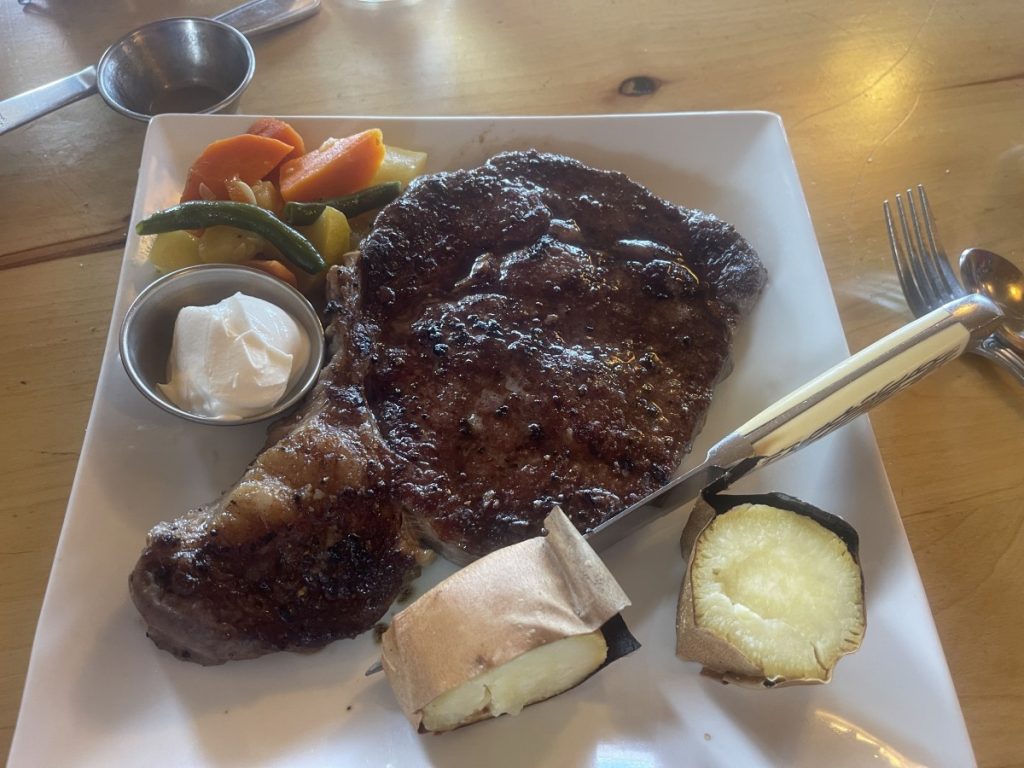
I choose a hotel in Torrey that Rick and I stayed at before on our first ride we did together that was to Sturgis back in 2016, The Broken Spur Inn and Steakhouse. You can park your bike in front of your room, and they have a steakhouse on site. I check in about 4pm, clean up, then head to the steakhouse and have a ribeye steak in honor of Rick.
I check on Rick while having dinner and see he is still cruising along on I-15, and later that evening he texted that he made it to Mesquite and that it was hot with extreme wind and poor visibility, but the good news was he made it and checked into a hotel.
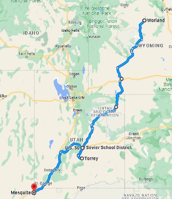
Rick and Jim’s routes for the day
Tomorrow I’ll be heading to Mesquite and Rick will be heading home.
This morning we are on our way to our 15th road in the 15 Great American Roads challenge, which is #16 in the list out of the 20 to choose from. Every morning Rick would check the weather of where we are going to give us an idea of what we might face. Todays report hot and sunny, with the added subject to change…..
We start our typical time of 6:30ish and we are rolling south west out of North Dakota into Wyoming today. Roads are straight and flat and sure enough, we are watching the morning skies as we seem to miss showers on our left and on our right, with a few sprinkles here and there. It wasn’t before long that we punched through this cloud cover and we were in sunshine and the day’s heat started to accumulate.
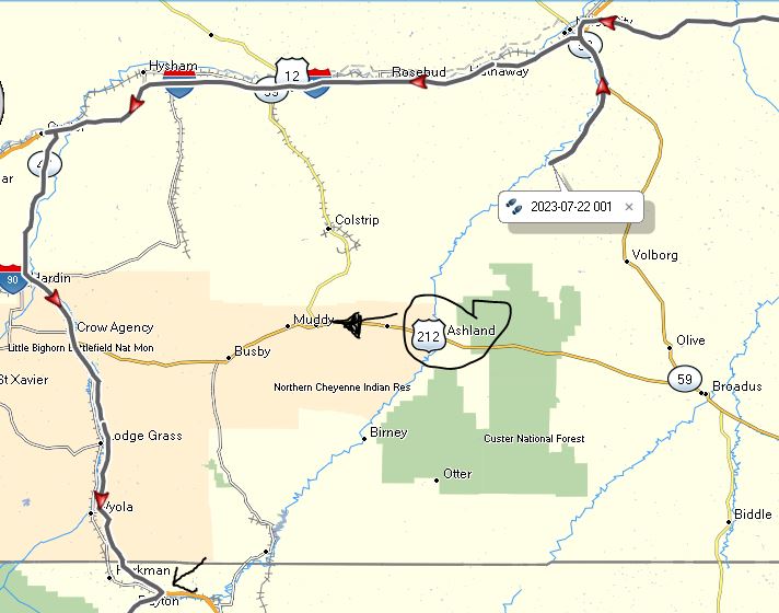
We again are doing the back roads and we come through a town called Miles City in Montana crossing the interstate and we stay on the back roads out of that town. The road is fast cruising along ranches that seem to last forever out here. We make another turn and we are traveling down a road and I feel things constantly hitting my feet. They are not rocks, but just a constant splattering of grasshoppers are hitting us about from the surface to 3 to 3 1/2 feet high, pelting our bikes and what ever is exposed at that level. We past a farmers truck and while passing the splattering intensifies as the truck seems to be pushing more grasshoppers in our path. I take a gander at my boot as we are riding and it has changed color.
After about 40 miles since we past the town I start downshifting because of what I see ahead. We come to a stop on this road because the pavement ends and it is gravel. We have been using google maps to navigate back roads. We just set our destination, change the options to avoid highways, and we have had very good luck with our outcome most of the time, we never had this issue. We didn’t know if it was just a construction patch or what, so we ride slowly about 100 yards further to see over the crest and the road is still gravel. A couple of ranchers trucks stop and check on us. I question them how long is the gravel road and what is its condition? The report is it is gravel all the way to Ashland, 35 miles away. The condition is washboard then it deteriorates with some potholes for a bit, last 10 miles the road is good.
We opt not to tackle the road as but at a pace of 10 to 20 mph, it would take us about 2 1/2 to 3 hours and do a number on our bladders. Our route was to take us to Ashland to Route 212, then take that west to Arapoosh. Not really much options out here as roads are far and few between these vast areas. We double back to Miles City through the grasshopper killing field and hop on the interstate a bit to take another back road, but now we are a bit leery of Google maps. Never had this happed this whole time. The detour probably added another hour to our riding today.
you can see where we did stop and turned around, and our actual route by the arrows. We were to head to Ashland, then west on 212, so it wasn’t too bad.
The day is hot at this point, in the low 90’s with some humidity. We continue along and the skies are clear and at about 2:30ish in the afternoon we arrive in Ranchester WY to document and start our ride #15. Both of us have done this road before, for me twice and always west to east in direction (and one time in a tow truck – another story). Roads take on a different flavor on direction of travel – the vistas are different on the direction of travel and you get another perspective of the area. This was a treat approaching this ride from the east and it was beautiful. The road is a pass, over the mountain areas in the Bighorn National Forest. The temperatures dropped about 30 degrees when we were on the summit plateau. Typical of mountain passes that you do in the afternoon, the area usually has showers and this was no exception, but we stayed in the sunshine and just had some wet roads as we missed the showers again. We stopped a few times to enjoy the scenery before heading back down the mountain.
Once down in Greybull, it was back up to about 92 degrees and a slight breeze for our documentation at the post office and the gas station. It was about 4:30-5:00 pm and a decision was needed on where to go for the night. I was thinking about a historic hotel right in Greybull, but decided to start heading south to the next town and see how we feel and what we find.
The next town we saw a Days Inn which was all single story, park in front of your room, and the upkeep was pleasant in this barren type of terrain. It wasn’t your typical Days Inn. We check inn, they have for us fresh baked cookies , ice tea and coffee, and ice cream! Outside, we find a hose and they say sure, clean your bikes, which Rick started to get rid of all those grasshoppers that committed suicide. Next door was a non descript pizza/bar establishment which was lively on the inside and good food after a long day.
In planning these rides, originally we thought we would be in Michigan on the last week on July. We ended up being there mid month. At that point we made the decision to skip Sturgis as we are early, and when we were going after our last 15th road, we chose to go home after that as oppose to go after the 20 roads that we originally set out to do. We have been on the road for 5 weeks now on phase 2 and I think both of us miss our beds and have tasks to do that are in the back in our minds with our lives back home. Plus we have one more big ride over labor day weekend. Getting home early to take care of a few things and relax. and also enjoy summer in California was part of the attraction.
With our bellies full of pizza, we retired for the night to get an early start the next morning.
This morning we are heading to Dickinson North Dakota for Ride #17. Our weather for the most part has been great, meaning we haven’t had much rain to deal with. We have been missing most of the storms and any rain we have been running into, it light and just a passing shower.
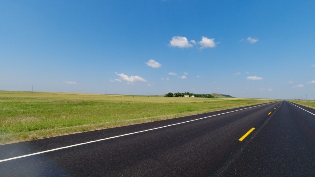
North Dakota is the definition of the plains state. You barely see a tree much of the time, there is nothing to stop the wind, the roads are straight, long and far few in-between, it is usually hot and dry during the summer months, and today was no different.
Still on back roads so we are not racing the trucks on the interstate, we ride towards Dickinson – about a 300 mile day. The terrain does vary from time to time as you rise and fall between ridges of open space and grass lands. I usually do most of the leading on the days and Rick took a charge on passing some trucks before I did and I let him lead the rest of the day as it was a nice change for me. You don’t worry about setting a pace, the next turn, etc… You can relax a bit and look around and just keep up.
It was about mid day though when Rick got a surprise. We just came by a small curve in the road and we were heading up a slight grade when I saw a deer come jumping out of the big ditch on the left side onto the road in front of Rick! We were traveling in the high 70’s at least. This was no small deer either and I let off the gas wondering what Rick’s move was going to be. Deer can turn and jump on a dime and you just really can’t do much but make a decision and stick to it.
I think Rick’s was to give it some gas and see if he can get ahead of him as he was by his side. From my perspective I saw the head go down and boom!, he hit the bike on the side, and Rick’s bike didn’t budge much and I see the deer’s legs go up in the air, he is summer salting and tumbles to the ditch off to the right. Thank God Rick didn’t go down.
I slow down and I see Rick looking at his bike, slowing down too, still checking his bike and looking at his bag and Rick eventually pulls off to the shoulder. He was OK, said the deer looked him in the eye and he thinks he hit his bike at his rear saddle bag, which was now loose.
As Rick checks his bike and fixes his loosened bag, he wants me to go check about the deer. I circle back a 1/4 mile and slowly ride back looking into the ditch but see nothing. No deer and the only remnants was some bit of fur that was on the corner of Ricks saddle bag.
Rick gets his bag affixed properly, it appears he has no damage, hops on his bike and we are going 80 in a matter of minutes. Rick passes by gas stations and these stretches’ can be long with no warning. He is carrying extra gas and we don’t really know the range of his bike. His gauges appear to reporting less than what we know is in his tank holds, but he doesn’t know the useable gas and I think he wanted to test it out on this leg as I’m only going to have 30 miles reported left when we get to Dickinson.
When he gets to Dickenson, his gauges show him as no miles left, he still running and when he fills his bike, still has 1/2 gallon left It’s still early, so we check in to our hotel and then leave to go do our ride #17 in the National Park.
About 20 miles west of Dickinson the flat plains suddenly have rolling hills and canyons. This is where the park is located. The park was created in 1947 to honor President Roosevelt and to provide a place for us to experience his beloved Badlands in our own way. Theodore Roosevelt always said he would never have been President if it had not been for his experiences in North Dakota.
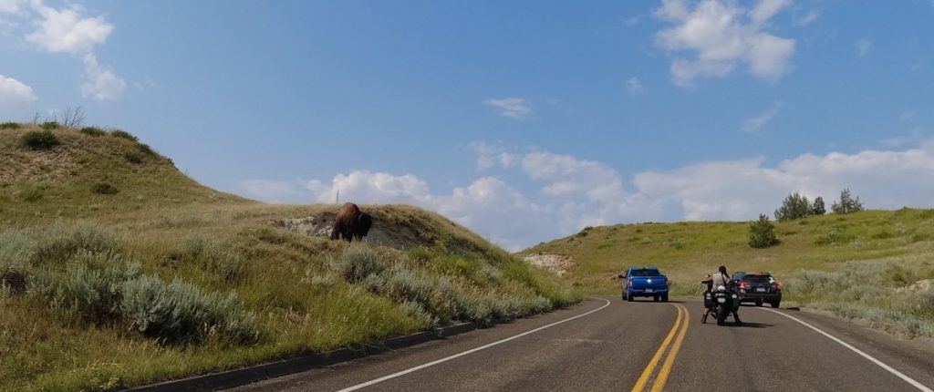
The park loop road was our ride, but due to a washout, we could only ride 22 miles in, and then 22 miles back. The loop was only 35 miles, so we actually rode more. The ride took use through canyon badland areas, to vista and overlooks accompanied by wild horses and an occasional bison. We slowly rode to the closed portion, checking out vistas along the way, then return and made our way back, did our documentation and rode back to the hotel. Ride # 14 for us is in the books, now for #15, which is #16 on the list, Bighorn Scenic Byway Wyoming US14 Ranchester WY to Greybull WY.
We woke up the typical early timeframe and we were rolling by 6:30ish. We swung by the post office to do our documentation photos and to the nearest gas station to fill up and to get a receipt.
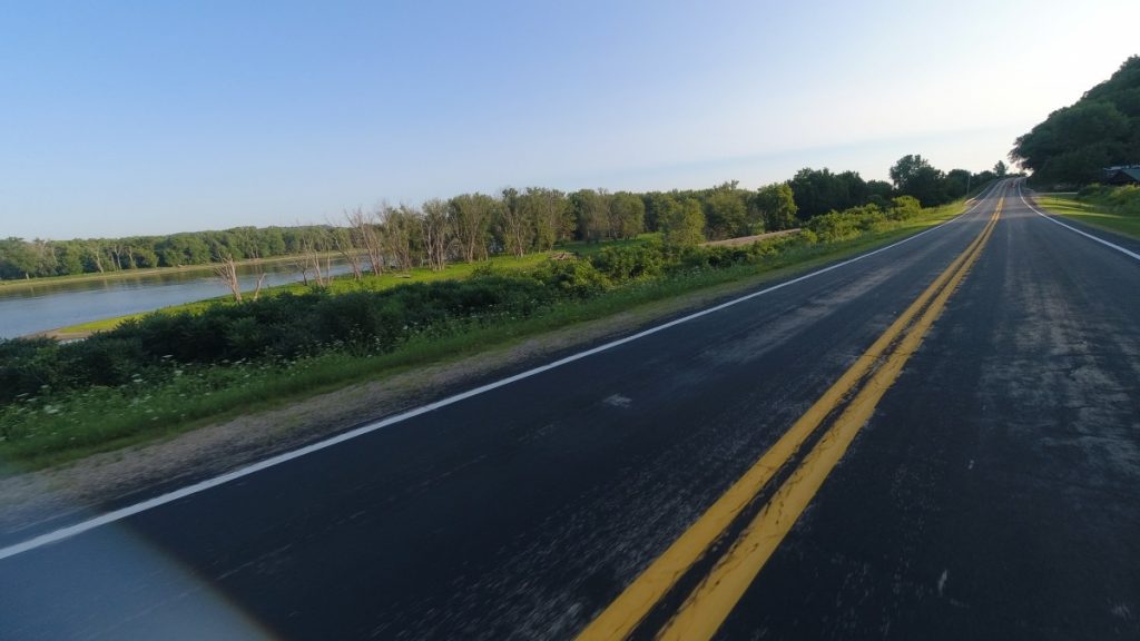
The other day as we approach Prairie Du Chein, we were basically just riding on a flat area, but just before coming to town we dropped down into this “valley”. It made sense now as we started riding the Great River Road. we are riding north on the east side of the river. To my right was a hillside and we were in the shade because the sun was still below the grade were were at. Ahead of me was the road that basically ran straight with some minor curves to keep the ride interesting. To my left is the Mississippi, flat wide river with noticeable marsh areas along it’s banks. Across the river you see the hillside on the west side of the river.
This “valley” was probably created by this river on my right many years ago when water flowed more prominently from the glaciers retreating and it carved down the land. What we were riding on was probably under water at some time. I’ve only just crossed the Mississippi river on a bridge, never ran along it and only knew of it when you hear about flooding in the new. Rick on the other hand, had tall tales of his youthful years boating on this river as he grew up near it. As we road we pasted many small dams and locks, which Rick said they would just jump over them with the boats when they didn’t want to pay the lock fee or just because they wanted to, or just because they had a few too many. We were able to see barges being negotiated along the river with tugs as we progress north.
The ride for us was cooler because we were in the shade from the hill on our right side, but there was plenty of sun shining on the Mississippi. The road would occasionally rise and fall as we continued on this 60ish mile jaunt to LaCrosse, and within the hour we were in LaCrosse. We filled up, did our documentation, and then we continued east to ride #17 which is Theodore Roosevelt National Park in North Dakota, 600 plus miles away. Rick choose a halve way point of Watertown South Dakota. We crosses the Mississippi into Minnesota and the road got interesting for the next several hours.
After we got out of Milwaukee proper, we have been on back roads and we are continuing it. This part of Minnesota has hills and we had fun roller coaster farm roads with plenty of dips and limited sight hill humps to do as we snaked west. Eventually though even Minnesota gives way to the plains as the terrain gradually had less trees, the land flatten out and the day got hotter and windier. We pulled into Watertown, found our hotel, cleaned up and went to dinner to Dempsey’s Brewery, and you got it, pizza!
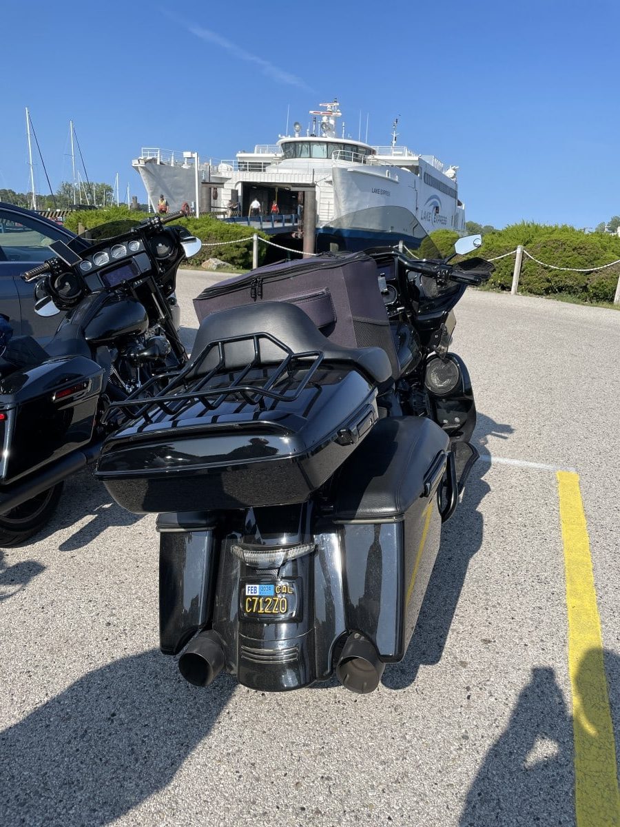
Well fish smell after three days and we needed to get going to get our remaining 3 roads for the 15 Great Roads in America. Our next road is number 18 on our list, Great River Road Wisconsin, WI-35 Prairie du Chien to LaCrosse. We didn’t want to bother with dealing with Chicago, so we opted to take the Lake Express, a passenger and vehicle ferry boat from Muskegon Michigan to Milwaukee Wisconsin. The only challenge was we did not pre-purchase our tickets for the ferry and we wanted to catch the 10:15 AM ride instead of the 4:30 pm ride. Since it was a Wednesday we had a pretty good chance to get our tickets, but we needed to leave early to make sure we got to Muskegon by 9:00 am when they opened. So we had a scrapes of daylight departure time of wheels up at 6:00 am.
We had no traffic issues and arrived in plenty of time to get our tickets and take a break in the day to cross Lake Michigan. We do our own strapping down of the bikes but they do provide tiedowns.. It was a clear day and the water was calm for this boat to cruise across the lake at about 38 knots to arrive in Milwaukee in about 2 1/2 hours. Our departure was @10:15 and by 12:45 pm we were disembarking off and starting our ride to Prairie Du Chien. We end up staying at the Waterfront Hotel on the Mississippi river right off old town Prairie Du Chien where we find a Irish Pub for dinner as we prep for tomorrows ride.